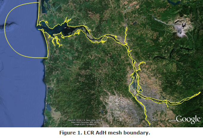
This study was conducted for the U.S. Army Corps of Engineer District, Portland, to provide a regional tool to capture 2-Dimensional hydraulics of the Lower Columbia River (LCR) Estuary. The inland boundary of the project is the Bonneville Lock and Dam, a regulated structure, and the project extends beyond the mouth of the Columbia River (Figure 1). There are five inflows into the model domain: the Cowlitz, Lewis, Willamette, and Sandy Rivers, and the Bonneville L&D.
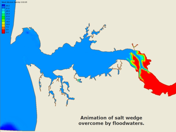
In addition to hydraulics, several runs were completed to demonstrate AdH Module Functionality. These runs included salinity, temperature, vessel movement, and sediment transport.

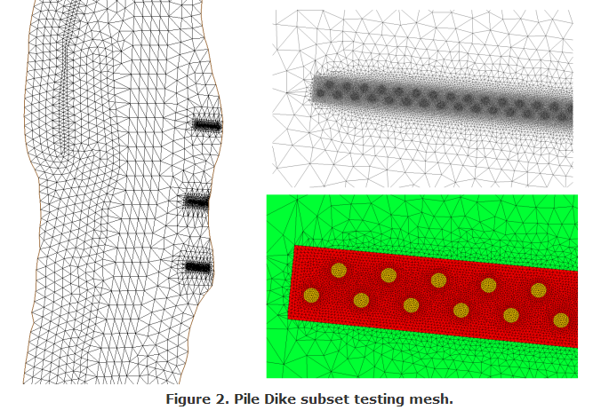
Over one hundred and twenty pile dikes are included in the LCR mesh and each pile dike can contain several hundred individual 12-24 inch diameter piles. If these piles were modeled individually (the most accurate method), the resolution requirements at that scale would greatly reduce model efficiency. Though AdH can handle this dramatic increase in resolution, a simpler and more computationally efficient method is available using AdH's Friction Library. As a test, a subset mesh was constructed to mesh and model individual pile dikes (Figure 2).

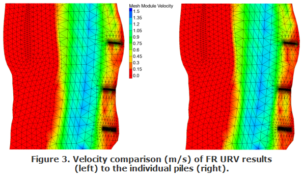
Using the same mesh, a pile dike "region" was specified by material type using the FR URV card in AdH. Comparison of the two results show that the FR URV card can reproduce far-field velocity results with a dramatic increase in model efficiency (Figure 3).

For more information, contact the project lead, Kim Pevey, U.S. Engineer Research and Development Center (ERDC), Coastal and Hydraulics Lab (CHL).